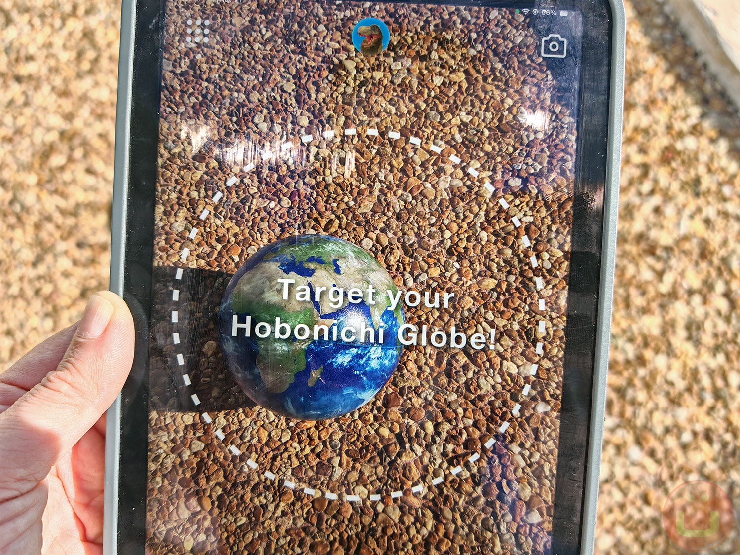
 The Hobonichi Globe, launched in August 2024 for the US and UK markets, brings a great blend of education and technology to geography enthusiasts of all ages. This 5.9-inch (15 cm) AR-enhanced globe combines physical and digital experiences, offering dynamic, real-time views of the Earth when paired with its free companion app, available for iOS and Android devices.
Since its debut in Japan in 2017, the Hobonichi Globe has received prestigious accolades, including the Grand Prize in the Functional Category at the 2021 ISOT Tokyo Stationery & Office Products Fair and the 2023 Kids Design Award. Here’s a closer look at what makes this innovative product so unique and educational.
What is the Hobonichi Globe?
The Hobonichi Globe stands out for its minimalist design and portability. Unlike traditional globes, it has no fixed base or supporting axis, making it easy for young children to handle and explore. Its borderless, label-free surface mirrors Earth as seen from space.
Designed for kids aged six and up, and for adults, the Hobonichi Globe comes with a durable polycarbonate stand that keeps it stable during use. This is especially helpful when engaging with its Augmented Reality (AR) features.
How It Works
The free Hobonichi Globe App allows users to explore detailed AR content in English or Japanese.
Simply point a smartphone or tablet around the globe to access real-time Earth data, including cloud cover, rainfall, wind patterns, temperature updates, and more educational content. The app brings the Earth to life with augmented reality (AR), transforming static geography into an interactive learning experience.
Our Hands-On Experience
We tested the Hobonichi Globe over several days on our iPad Mini and found it entertaining and educational. For a more immersive experience, we recommend using a tablet rather than a smartphone. Lighting is crucial—the app performs best in well-lit conditions but struggles in overly bright or dark environments.
Below, we have listed all the tested features and how they work. We have added a few screenshots of our hands-on experience :
Key features include:

Left: Earth Now. The Clouds option shows an animation of cloud movement over the past day. Other options include Rain and Temperature. — Center: Earth This Week. The Temperature option presents a video of temperature changes over the past 7 days. Other options include Clouds and Rain. — Right: Earth at Night. Displays a nighttime view. – All views are displayed with countries’ information on (i icon ON at the bottom)
Earth Now:
- View live updates of the Earth’s weather patterns, such as cloud distribution, rainfall, and temperature changes, refreshed every hour.
- Toggle specific data layers (e.g., clouds or temperature) for customized views.
- Watch time-lapse videos showing Earth’s transformation over the past 24 hours.
Earth This Week:
- Download and view a week-long video summary of weather patterns, including the evolution of cyclones and global temperature shifts.
- Use the time slider for frame-by-frame playback of notable weather events.
Earth at Night:
- Experience how the planet looks at night, with illuminated cities and fishing boats lighting up the oceans.
- Toggle day and night views to observe how urban centers and borders emerge against the darkness.
Interactive Learning Features
Beyond real-time Earth observation, the Hobonichi Globe offers a variety of engaging educational tools:
Countries
Transform the globe into a digital atlas. Tap on a country’s flag to read about its culture, geography, and key facts. Information is presented with clear visuals, making it accessible and enjoyable for users of all ages.

Left: Countries. Clicking on a flag in this view displays information about the corresponding country. — Center: Picture Atlas —Right: An information screen is displayed after selecting an image in the Picture Atlas view. All views have country information turned off by default (toggle using the i icon at the bottom).
Picture Atlas
Explore photos of iconic landmarks, historical sites, wildlife, and vehicles. Each image is paired with educational details, helping users learn more about the wonders of our planet.
Poplardia Dinosaurs

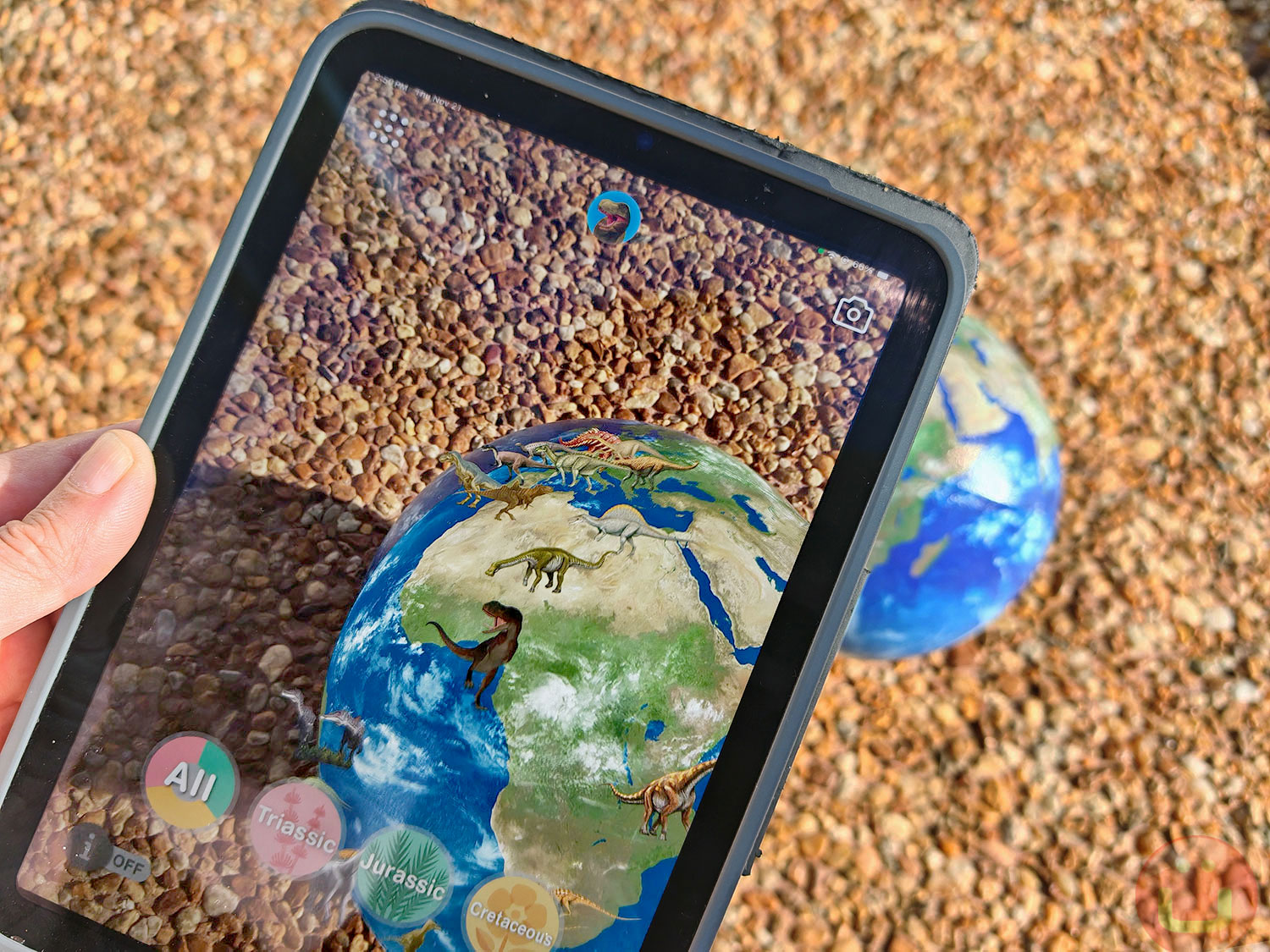
Left: Poplardia Dinosaurs, Cretaceous option. Three other options: All, Jurassic, and Triassic. — Center: Poplardia Dinosaurs. All dinosaurs from all periods are displayed —Right: An information screen is displayed after selecting a dinosaur in the Poplardia Dinosaurs view. All views have country information turned off by default (toggle using the i icon at the bottom).
This feature brings Earth’s prehistoric past to life. Users can view 50 dinosaurs from the “Poplardia Wonda Illustrated Encyclopedia of Dinosaurs” by Poplar Publishing, sorted by their eras: Triassic, Jurassic, and Cretaceous. By observing where these creatures once roamed, learners gain insight into their evolution and extinction.
Classic Globe
For those who prefer a traditional approach, the app offers a color-coded map displaying country boundaries, elevations, and familiar latitude and longitude lines.

Left: Classic, Topographic option. Two other options are Political and Satellite. — Center: Pop-up Peaks with Closer Looks toggle on — Right: Clicking an orange rectangle in the Pop-up Peaks view opens an information screen.
Pop-up Peaks
Dive into Earth’s topography with an exaggerated elevation model. Magnified 100 times, this feature highlights significant geological formations like the Himalayas and Antarctica’s ice sheets.
Playful and Creative Tools

Left: Elephinder. 1/ Type the place you are looking for. — Center: Elephinder. 2/ An elephant will appear at the location you searched for. — Right: Photosphere. Select an image and see it wrapped around the Hobonichi Globe
The Hobonichi Globe doesn’t stop at education, it adds a playful twist to geography:
- Elephinder: Trouble finding a location? This virtual elephant assistant can help, though its accuracy can vary.
- Massive Message: Write personalized messages and launch them into a virtual orbit around your EarthBall.
- Photosphere: Add your photos to the app and see them wrapped around the virtual globe on screen.
Who Is It For?
The Hobonichi Globe is ideal for curious minds aged six and up. Its combination of tactile and digital interactivity makes it appealing to a wide audience, from kids learning geography to adults passionate about Earth sciences. Educators may find it particularly useful as a classroom tool, while families can enjoy it as a fun way to learn together.
Technical Details
Size: 5.9 inches in diameter.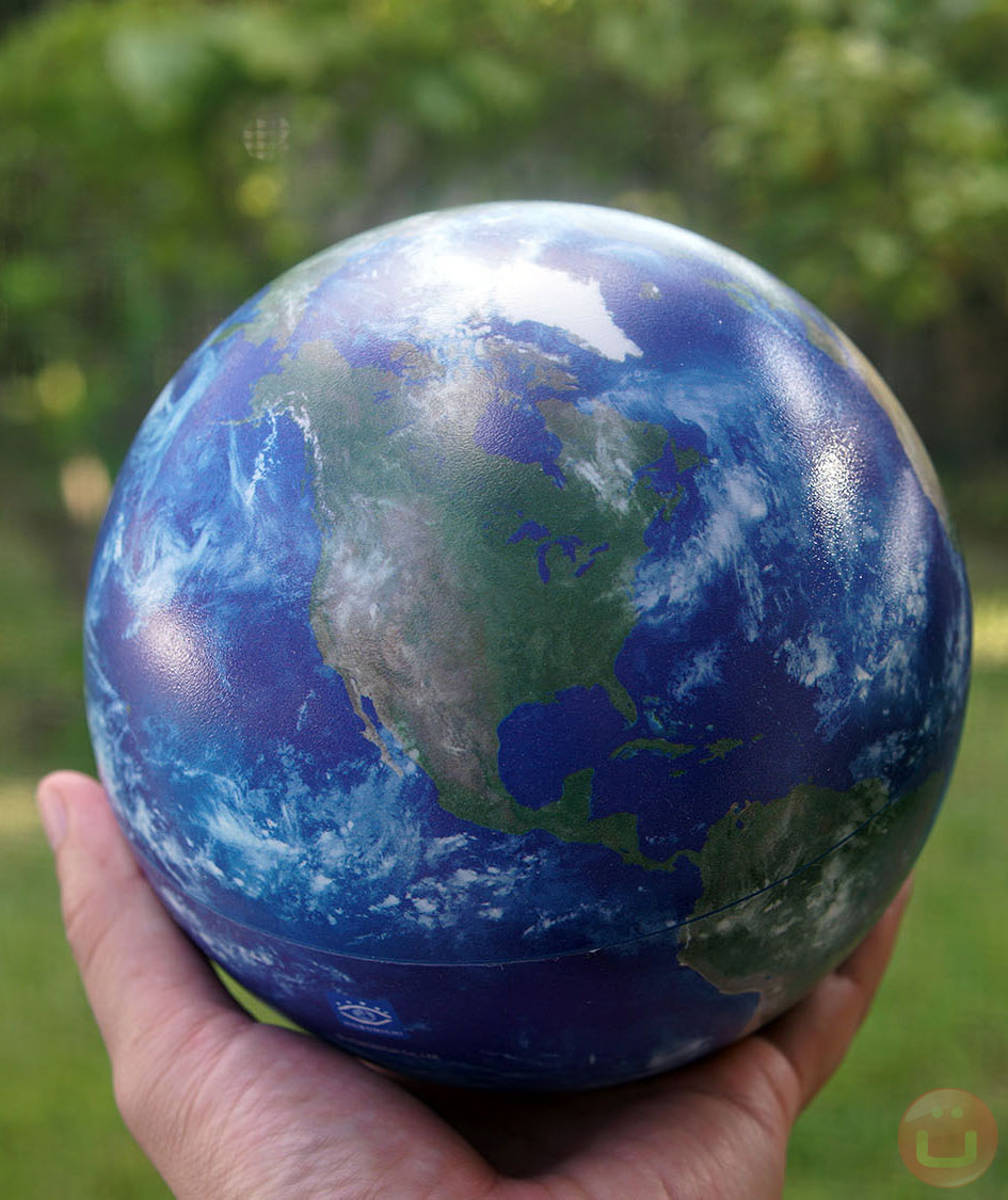
Stand Material: Durable polycarbonate.
App Compatibility: iOS and Android.
AR Data Sources:
– Cloud and temperature data: Custom Weather.
– Rain imagery: JAXA’s GSMaP.
– Dinosaur content: Poplar Publishing.
Topographic research: Tokyo Metropolitan University’s Hidenori Watanave Laboratory.
Product Page: Hobomichi Globe
Price at launch: $45.99 (US) and £44.95 (UK)
Buy on Amazon US or Amazon UK
Hobonichi also offers a 7.9-inch globe at a higher price (see the product page at the bottom). We tried the 5.9-inch version, and the free application is the same for both.
Product Discovery Article: This article is sponsored by Hobonichi Co., Ltd. We have tested most of the features and confirmed that they work as intended.
Discover the Hobonichi Globe: Bringing Earth to Life with Interactive Augmented Reality
, original content from Ubergizmo. Read our Copyrights and terms of use.


